Maps, Memory, and Mercy: How Amazon Guardians Shield Colombia’s Uncontacted Peoples

Recognition Won From Below
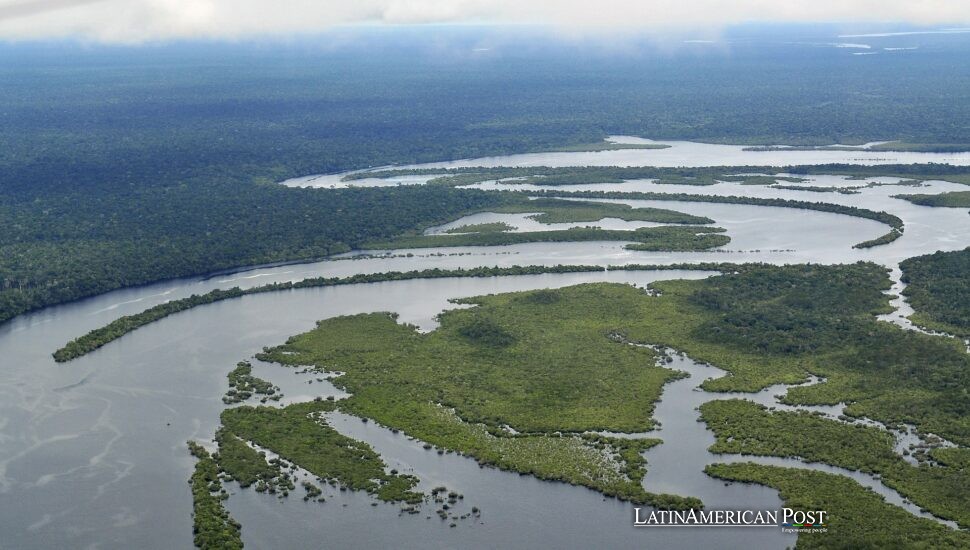
When Colombia finally issued its October 2024 resolution acknowledging two voluntarily isolated peoples—the Yuri and the Passé—the applause rose first from riverbanks, not ministries. The credit belonged to neighbors who had been watching, walking, and warning for years: the communities of Manacaro and the Curare–Los Ingleses Indigenous Reserve along the lower Caquetá River. Their evidence looked humble—footprints, charred ash circles, stripped palm hearts, seeds left in deliberate trails—until it coalesced into a map the state could no longer ignore.
The backdrop is volatile. Ombudsman alerts flag missionaries courting contact, armed groups shifting drug corridors, and illegal miners chewing at the edges of protected forests. Since March 2020, even Colombia’s National Natural Parks staff have been largely barred by violence from entering Cahuinarí, Río Puré and northern Amacayacu. Trying to manage from far-off Leticia “makes it difficult to carry out research and biodiversity monitoring,” the agency told Mongabay Latam, and “limits the possibility of conducting walkthroughs for prevention, surveillance and control.” In other words: where rangers cannot walk, locals are the only ones still out there.
Recognition, then, was not a decree from above—it was a receipt for work done below. It names a truth. It does not, by itself, fund or defend it. On the lower Caquetá, the first responders are neighbors with notebooks, not soldiers with radios.
A Community Shield Woven From Culture and Code
The shield begins as an agreement, not an algorithm. Manacaro and Curare–Los Ingleses share a 2,338-hectare “agreement strip”—a living buffer for fishing, hunting, and gathering. Monthly assemblies tally what was taken, plan what should be left, and compare notes from patrols: who went where, what they saw, what they heard. “Using the ‘agreement strip’ that we have, we are uniting to protect our isolated brothers, because the territory is very large,” said Ezequiel Cubeo, the highest authority in Curare–Los Ingleses, in an interview with Mongabay.
What began as social cartography—maps made from memory—grew sharper without losing its soul. GPS units pinned coordinates to stories. Tablets reduced the steps from sighting to record. QGIS and ArcGIS helped visualize river levels and canopy breaks, so patrols could spend scarce fuel where it mattered. This is not data worship; it is data sovereignty. The information remains owned and governed by the communities that produce it. “Community monitors are in the best position to track biodiversity and environmental pressures, since they are the ones who are permanently in the territory,” said Juana Hoffman, territorial adviser at ACT, to Mongabay.
The work also widened who counts as a monitor. In Manacaro, the river layout lets women lead patrols at dawn, log wildlife and warning signs by midday, then return to teach children what the river told them. Quietly, a gender shift has followed the current. Women manage spreadsheets, compile reports, and stitch isolated sightings—a smoky column here, fresh cut stumps there—into patterns that function like an early-warning system. When a miner’s dredge nudges across an invisible line, a grandmother with a notebook often notices first.
Even the map of protection has matured. Of Curare’s 212,000 hectares, the community set aside 129,408 for conservation and 82,592 for harvest back in 2008—years before the state conceded the Yuri and Passé existed. They built Puerto Caimán, a guard-cabin on a branch of the Caquetá, to watch black caiman and salt licks where tapirs feed—and then used the same vantage to watch for trespass that could trigger unwanted contact. “It all began by recovering the territory,” recalled historic leader Darío Silva to Mongabay. Recovery, here, means a place to sleep safely, to stand guard, to start again.

Spiritual Consent in a Theater of War
Calling this work “monitoring” can miss its heart. Before each month-long patrol heads upriver, an elder travels to Puerto Caimán to perform protective rites—a shield for the family going out, and a consultation with unseen neighbors. In the Bora and Miraña worldview, consent is a boundary you feel before you cross it. “It is crucial that the elder takes that precaution, from the cultural side, so that the lookout guards can arrive in their area,” said Cubeo. If the elder “finds, in his thoughts, that the family cannot go, that mandate is respected,” he told Mongabay.
Around them, the map churns. Dissident factions loyal to aliases like “Iván Mordisco” and “Calarcá” test new fronts. Illegal dredges test new creeks. Proselytizers test the no-contact principle with the most dangerous of good intentions. Parks biologists cannot enter; Manacaro’s children still need to learn where the salados are, which trails belong to the season, and when to step back because someone who prefers not to be seen has said, without words, not today.
The lesson for Bogotá is not quaint. The ritual protocols described to Mongabay are operational: a consent system in a region where the law’s reach is fragile. If elders say wait, the republic should learn to wait.
From Local Evidence to National Guarantees
Some scaffolding exists. After pressure from Indigenous and civil groups, the Interior Ministry created CNPIA in 2018—the National Commission for the Prevention and Protection of the Rights of Indigenous Peoples in Isolation. “The committee is the agency to make decisions and understand the territorial protection of these communities,” said David Novoa, ACT’s territorial coordinator for isolated peoples, to Mongabay. When it works, CNPIA turns local findings into national action.
There is proof of concept. In 2023, Colombia’s Land Restitution Unit adopted a preventive measure to protect the Yuri, Passé, and neighboring communities amid mining pressure on the Puré River. That measure didn’t appear from thin air; it climbed from motor canoes to spreadsheets to official paper. The next steps are obvious—and overdue. Build an integrated dashboard that merges community patrol logs with departmental intel. Fund monthly assemblies in Manacaro and Curare–Los Ingleses as the governance engines they already are. Train more women and youth as data stewards so the model replicates to places like Arica, near the Peru and Brazil borders.
Then move from paper to perimeter. Declare and enforce “intangible zones” where no outsiders—no prospectors, no proselytizers—may set foot. Resource the Attorney General to treat incursions as crimes against life, not administrative delays. Reinforce Parks so its biologists can return alongside, not instead of, community monitors. None of this is charity; it is constitutional. The right of Indigenous peoples to remain uncontacted is a right to be defended, not merely recognized.
“The collected information should protect the territory, the Yuri and Passé, and the other 16 peoples we have indications of,” said Silva. The aim sounds modest only because the scale of the threat is not.
If recognition remains just a sentence in the record, it will read like an epitaph. If, instead, Colombia funds, trusts, and defends the community systems that forced recognition into being, it can turn a fragile truth into a durable guarantee. The template is on the river already: ritual consent braided with remote sensing, elders’ counsel with Excel, daughters logging data beside grandmothers.
The Caquetá keeps flowing. Parks remain, for now, off-limits to many of the very officials tasked with protection. In Manacaro, a mother yanks an outboard to life while her child notes the waterline; in Puerto Caimán, an elder looks east and asks—first—to be allowed to ask. The fate of Colombia’s isolated peoples may hinge on whether the country is willing to call that sequence what it is: governance.
Also Read: A Tortilla Shop That Refused to Vanish: The Hispanic Soul of Tucson’s Barrio Anita


