Latin America Unites in Peru to Strengthen Volcanic Surveillance

The Peruvian city of Arequipa is hosting the IV Operational Meeting of the Latin American Association of Volcanic Geodesy (Geovol) this week, bringing together experts from across the Americas to enhance collaboration in monitoring volcanic activity and mitigating disaster risks.
Arequipa, the “white city” of southern Peru, has become the focal point for the scientific community this week as it hosts the IV Operational Meeting of the Latin American Association of Volcanic Geodesy (Geovol). The event began on Monday and is a significant gathering aimed at strengthening collaboration across the Americas in volcanic monitoring.
The meeting, organized by Geovol with support from various international organizations such as the United States Agency for International Development (USAID), the United States Geological Survey (USGS), and the Volcanic Disaster Assistance Program (VDAP), is being hailed as a critical event for advancing the science of volcanic geodesy. The event’s host, the Peruvian Geophysical Institute (IGP), emphasized its importance, noting that it will provide a platform for scientists and professionals from Argentina, Chile, Peru, Ecuador, Colombia, Costa Rica, Guatemala, El Salvador, Mexico, and the United States to engage in specialized courses, interactive workshops, and in-depth discussions.
Over the next ten days, participants will focus on improving techniques for monitoring volcanic activity and interpreting geodetic data to anticipate eruptions and enhance disaster response capabilities. As Juan Carlos Villegas, an expert in geodesy at the IGP, pointed out, these activities are crucial for refining the tools and methodologies used to monitor active volcanoes and predict potential eruptions.
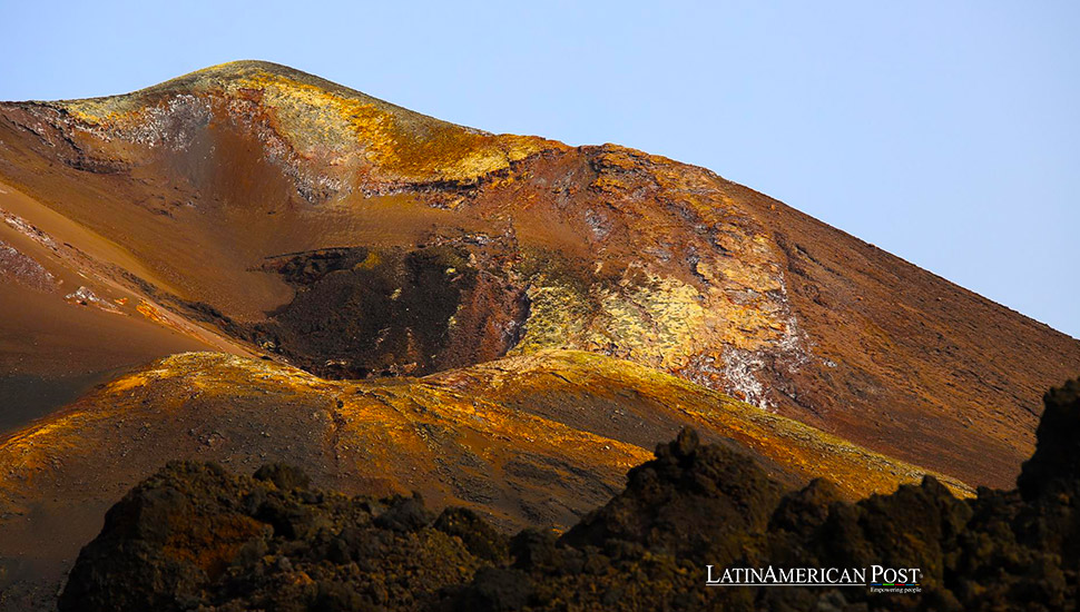
Hernando Tavera, the executive president of the IGP, highlighted the advancements in volcanic monitoring technology, particularly the use of GNSS receivers, inclinometers, and SAR image analysis. These tools have been instrumental in gathering critical data to assess the reactivation of active volcanoes, such as Ubinas and Sabancaya, located in the Arequipa region. The ability to monitor these volcanoes closely is vital for ensuring the safety of the surrounding communities.
“Geovol 2024 represents a unique opportunity to strengthen the Latin American scientific community in volcanic geodesy, promoting a collaborative approach to volcanic risk surveillance and management,” said Katherine Vargas, coordinator of the National Volcanological Center (Cenvul). She added that this gathering will help consolidate collaboration networks among the participating countries, contributing significantly to the safety and well-being of communities in volcanic risk zones.
A History of Disasters
Latin America is home to some of the world’s most active and dangerous volcanoes, making the region particularly vulnerable to volcanic disasters. The history of volcanic eruptions in this region is marked by catastrophic events that have devastated human populations and the environment.
One of the most infamous volcanic disasters in Latin American history was the eruption of Mount Pelée on the island of Martinique in 1902. Although not part of continental Latin America, this eruption is a stark reminder of volcanoes’ destructive power. The eruption destroyed the town of Saint-Pierre, killing an estimated 30,000 people in just minutes. It remains one of the deadliest volcanic eruptions in recorded history.
In 1985, Colombia experienced one of its most tragic natural disasters when the Nevado del Ruiz volcano erupted, triggering a massive lahar—a deadly mudflow composed of volcanic ash, debris, and water—that buried the town of Armero. The disaster claimed the lives of more than 23,000 people, making it one of the deadliest volcanic events in the 20th century. The eruption highlighted the importance of volcanic monitoring and the need for effective disaster response strategies.
Mexico, another country with a long history of volcanic activity, has also witnessed significant eruptions. The Popocatépetl volcano, located near Mexico City, has been particularly active in recent decades, posing a constant threat to millions of people living in its vicinity. The Mexican government has invested heavily in monitoring the volcano, employing advanced technologies to track its activity and provide early warnings to residents.
Ecuador’s Tungurahua volcano is another example of a highly active and dangerous volcano in Latin America. Since its reawakening in 1999, Tungurahua has erupted multiple times, causing widespread damage to nearby communities and forcing thousands of people to evacuate. In collaboration with international partners, the Ecuadorian government has established a comprehensive monitoring system to closely monitor the volcano’s activity.
These historical examples underscore Latin America’s critical need for effective volcanic monitoring and disaster preparedness. The region’s geologically active landscape, combined with dense populations living near volcanoes, makes it imperative for governments and scientific communities to work together to mitigate the risks posed by volcanic eruptions.
Advanced Technology and Collaboration in Volcanic Surveillance
The Geovol meeting in Arequipa is a testament to the growing recognition of the importance of advanced technology and international collaboration in volcanic monitoring. Over the years, significant strides have been made in the development of tools and techniques for tracking volcanic activity, enabling scientists to better predict eruptions and reduce the risks to human life.
One of the key technologies discussed at the Geovol meeting is the use of GNSS (Global Navigation Satellite System) receivers. These devices allow scientists to measure ground deformation with incredible precision, providing early indicators of volcanic activity. When combined with other tools such as inclinometers, which measure changes in the angle of the ground surface, and SAR (Synthetic Aperture Radar) imagery, which can detect subtle shifts in the Earth’s surface, researchers can develop a comprehensive picture of a volcano’s behavior.
In recent years, the integration of these technologies has led to significant improvements in the ability to predict volcanic eruptions. For example, in 2018, scientists were able to provide advance warnings of the eruption of Hawaii’s Kilauea volcano by closely monitoring ground deformation and gas emissions. These early warnings allowed authorities to evacuate residents and minimize the loss of life.
The collaboration between Latin American countries and international partners, such as the United States Geological Survey (USGS) and the Volcanic Disaster Assistance Program (VDAP), has been instrumental in advancing volcanic monitoring capabilities in the region. Through initiatives like the Geovol meeting, scientists from across the Americas can share knowledge, exchange best practices, and work together to address the unique challenges posed by volcanic activity in their respective countries.
As the Geovol meeting progresses, participants will engage in a series of specialized courses and workshops designed to enhance their understanding of volcanic processes and improve their ability to interpret geodetic data. These activities will not only strengthen the technical capabilities of the attendees but also foster a sense of community and shared purpose among the region’s volcanic monitoring professionals.
Building a Safer Future Through Scientific Cooperation
The Geovol meeting in Arequipa represents more than just a gathering of experts—it is a crucial step towards building a safer future for the millions of people living in the shadow of Latin America’s volcanoes. By bringing together scientists, government officials, and international partners, the event is fostering a collaborative approach to volcanic risk management that is essential for protecting lives and property.
As the meeting draws to a close, participants will leave with new insights, strengthened relationships, and a renewed commitment to advancing the science of volcanic monitoring. The knowledge and skills gained at Geovol 2024 will be put to use in the coming years as Latin America continues to grapple with the challenges posed by its volatile geological landscape.
The collaboration fostered at this event will also play a key role in addressing the broader issue of disaster preparedness in the region. As climate change and population growth increase the vulnerability of communities to natural disasters, the need for effective monitoring and early warning systems has never been greater.
The legacy of past volcanic disasters in Latin America serves as a sobering reminder of the importance of vigilance and preparedness. The Nevado del Ruiz tragedy, the destruction of Saint-Pierre, and the eruptions of Tungurahua and Popocatépetl all underscore the devastating consequences of volcanic eruptions. However, they also highlight the progress that has been made in recent years through the use of advanced technology and international collaboration.
Looking ahead, the lessons learned at Geovol 2024 will be critical in shaping the future of volcanic monitoring and disaster preparedness in Latin America. By continuing to invest in scientific research, technological innovation, and cross-border cooperation, the region can build a more resilient and safer future for its people.
Also read: Peruvian Machu Picchu’s Archaeological Revival
The Geovol meeting in Arequipa is not just an academic exercise—it is a vital step towards safeguarding the lives and livelihoods of millions of people across Latin America. Through the exchange of knowledge and the strengthening of partnerships, the region is better equipped to face the challenges of its dynamic and sometimes dangerous natural environment.


