Satellites: Forest watchers from space
The use of these elements allows us to analyze forests and other environments to determine their current state and evolution .
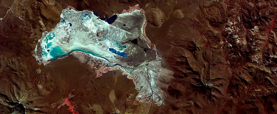
Satellites capture images automatically and consistently, allowing comparisons over time. / Photo: Flickr-General Coordination of Earth Observation / INPE
LatinAmerican Post | Jorge Guasp
Listen to this article
Leer en español: Satélites: observadores del bosque desde el espacio
Satellites help study nature, in order to protect it
For several years, the use of technology has been vital in the care of the environment. A tangible example is the use of satellites, which allow us to have eyes in all parts of the world and follow the melting of the poles, forest fires, natural disasters, etc.
The National Commission for Space Activities (CONAE) of Argentina, within the scope of the Ministry of Science, Technology and Innovation of the Nation (MINCyT), presents the first images of the Earth observation satellite SAOCOM 1B , which was put into orbit on August 30 and thus, together with SAOCOM 1A, completed the first constellation of Argentine radar satellites (First images of SAOCOM 1B show Argentina from Space, November 13, 2020, saocom.invap.com.ar. According to INVAP (Investigation Aplicada, a mixed technology company of Argentina), SAOCOM orbits 620 km, weighs 3000 kg, has a spatial resolution of 10 to 100 m, and was launched by the Falcon 9 of the SpaceX company.
Satellites can also be used to track the deforestation of forests. According to NASA, "Observations from Landsat satellites indicate that approximately 20 percent – 142,000 square kilometers (55,000 square miles) – of the Gran Chaco forest was converted to cropland or grazing land between 1985-2013."
Also read: Gran Chaco: the threatened forest that second in size to the Amazon
Background to remote sensing
More than 20 years ago, environmentalists had to recognize species in a forest through pairs of aerial photos, observed through a stereoscope , an optical instrument that joined the images and gave them a relief appearance.
Although not so much time has passed, today Google Earth allows us to observe the three-dimensional satellite image of any place in the world through a screen . Those photographs were taken from a plane in flight. Today, however, satellites capture images automatically and systematically, allowing comparisons to be made over time.
Features of the satellite survey system
Electromagnetic radiation, which is used to form satellite images of the Earth's surface, can be natural (sunlight) or artificial (active sensors, such as radar) . Radiation falls on objects, is reflected, and is captured by the satellite to form an image of reality.
The quality of the information that the satellite provides depends on the spatial resolution, that is, the size of the pixel (the small squares that we see when we enlarge a photo) of a raster image, where each pixel is a square with information. Each of these squares can measure between 1 and 1000 m. 30 m resolution, for example, means that each pixel in the image corresponds to a 30 m² square on the ground.
Geographic information systems
There are programs that process the information collected from the satellite, and integrate it into a Geographic Information System (GIS). This system contains not only satellite images, but also layers of base information (roads, rivers, infrastructure, etc.). These layers can be superimposed, so that several of them (rivers and roads, for example) can be seen at the same time on the background of a satellite image.
GPS (global positioning system) is a key instrument for the use of GIS, which is based on the connection with several satellites to determine the current position on the ground. Today, GPS is embedded in cell phones, watches, and vehicle displays, and allows you to navigate virtual maps in real time. The GPS stores points or routes surveyed on the ground, which can be uploaded to the GIS; It also allows to make corrections in the field of the information provided by a satellite image, and to georeference (assign points with latitude and longitude coordinates) the aerial photographs .
The GIS presents two formats for storing information: raster (the one mentioned when talking about the resolution of an image) and vector. The latter consists of vectors, that is, mathematically defined objects (lines, polygons, curves, etc.).
In general terms, we can say that some elements of the environment absorb more radiation than others, and that is why bodies of water, for example, appear black in an image. Snow, on the other hand, looks white because it reflects that radiation. GIS allows you to assign and change colors in each band of the electromagnetic spectrum, thus generating images with false colors. This change of tones enhances certain elements of the environment, which stand out better in one color than in another.
Each type of vegetation responds to radiation in different ways. This response is also modified when the same forest loses its leaves in winter, for example, or when it suffers a fire. To identify a certain type of forest cover, or to evaluate the evolution of a forest over time, the spectral indices of vegetation are used. According to an article published in the journal Ecosystems, these indices “are calculated from the mathematical combination of two or more bands of a multispectral satellite image and tend to present, more clearly, the characteristics of the vegetation. In the same way, they facilitate their isolation from other roofs and the evaluation of their condition ”.
As we can see, technology improves the ability to carry out surveys in the territory, especially on a large scale and in cases of fires, floods, changes in land use, etc. This information is relevant to become aware of the destruction of habitat caused by human activities, and to adopt measures aimed at protecting nature, without which our lives are in danger.


