Trinidad Volcano Rises as Venezuela Quakes Put NASA on Fault Watch Again
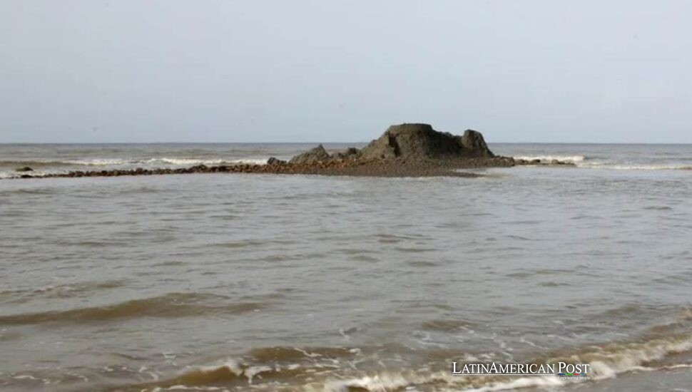
Off Trinidad’s southern coast, a newborn mud volcano is already washing away, while NASA maps a Venezuelan fault rupture that shifted land by two feet and redrew shorelines across a Caribbean region accustomed to unstable ground below.
An Island Born Under Pressure
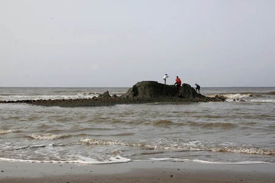
From a boat off Palo Seco, the new landform looks temporary. It sits low over the water, gray and raw, an island assembled from soft clay, rock fragments, and pale, calcite-rich boulders that resemble coral. Waves are already taking it apart.
Neil Sookram of Southwest Adventures, believed to be the first person to spot it, told EFE that erosion had continued for two days. The top remained largely unchanged while the clay hardened, and the sea kept reclaiming what the earth had pushed upward.
Geoscientist Xavier Moonan placed the mud volcano about 2.5 kilometers east of Beach Camp in Palo Seco and 3.3 kilometers east of the older Anglais Point Mud Volcano. It rises roughly four meters above the seabed. Initial images suggested that nearly one-third of the island had already washed away, Moonan told EFE.
Despite its name, this is not a volcano of lava and fire. Pressure below the surface forces water, clay, sediment, and sometimes gas upward through weak zones. In southern Trinidad, where petroleum geology has shaped the landscape and economy for generations, that subterranean world is familiar. The timing is not.
Moonan said the most likely trigger was the double earthquake that struck northeastern Venezuela on June 24. The University of the West Indies Seismic Research Center, the Institute of Marine Affairs and ResiLog Limited are analyzing samples to determine the material’s age and origin, separate from the earthquake damage elsewhere.
The island may disappear before those answers are complete. It is a brief record of pressure released across a tectonic system that ignores passports and political borders.
One Earthquake, Several Landscapes
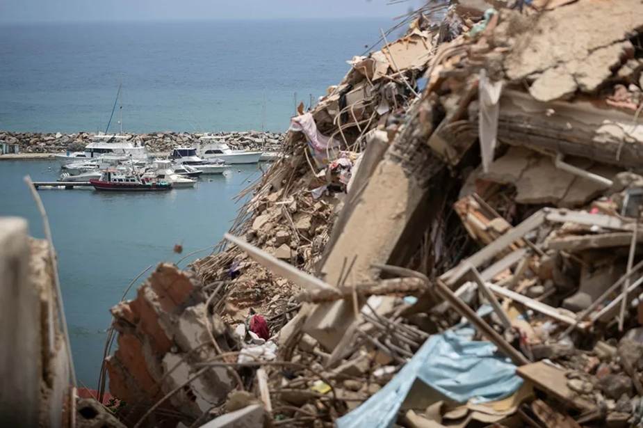
The mud volcano is only one of several changes along Trinidad’s southwestern coast. At Galfa Point in Cedros, geologists documented coastal uplift of about six meters, with part of the former seabed pushed above sea level.
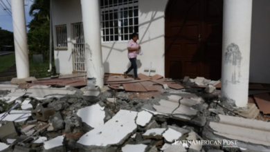
At Los Iros, the damage was more intimate. Roughly 50 acres of farmland were affected. Ponds drained through fresh cracks. Roads, houses, and coastal infrastructure suffered damage.
Moonan cautioned against treating every change as the same phenomenon. Near the mud island, the beach and cliffs showed no uplift, damage, or wider movement. The extrusion was triggered by the same earthquakes, he told EFE, but it was not the landslide-type process seen at Galfa Point or Los Iros.
That distinction matters. A dramatic island attracts cameras while quieter cracks undermine farms, drainage and roads. Caribbean disaster response often prioritizes the visible event, especially when budgets are tight and authority is divided.
Trinidad and Venezuela are separated by water but joined by geology, migration, commerce, and energy history. Communities on both sides of the Gulf of Paria know the contradiction of extractive wealth: oil and gas below, fragile infrastructure above.
In Venezuela, the magnitude 7.2 and 7.5 shocks killed 4,561 people, according to the latest official balance. Authorities counted 16,740 injuries and 17,907 people without housing, and the catastrophe became a displacement crisis as well as a seismic one. The government has recorded 1,254 aftershocks.
NASA Sees the Rupture
What residents experienced as violent shaking, NASA rendered as a displacement map. Data from the NASA-ISRO Synthetic Aperture Radar satellite, known as NISAR, showed that the fault ruptured from Morón, continued offshore, then returned to land near Caracas’s international airport.
South of the airport, the ground shifted by as much as 60 centimeters, nearly two feet. NASA said the fault belongs to a network of fractures along the boundary between the Caribbean Plate to the north and the South American Plate to the south.
The event activated NISAR’s urgent-response system for a major earthquake for the first time since the satellite entered orbit a year ago. The system can process maps within 12 to 24 hours, giving rescuers and planners a fast view of where the surface moved most.
That speed offers something Latin American disaster management has often lacked: a common picture before rumor, politics, and institutional rivalry harden into competing truths. Satellite data cannot clear a road or comfort a family. It can show where to look and how a rupture crossed coastlines managed by different governments.
The new mud volcano off Trinidad is the smaller story only by body count. Symbolically, it carries the larger lesson. Venezuela’s catastrophe did not stop at the shoreline; it lifted seabeds, drained ponds and squeezed clay into daylight across another country.
Soon, the waves may erase the island. NASA’s radar will keep its measurements, scientists will keep their samples, and residents will keep watching the coast. The Earth has already revised the map. The harder question is whether Caribbean institutions will revise their plans before the next fault does it for them.
Also Read: Peru Unearths Caral’s Tiny Gods and a Civilization’s Long Memory