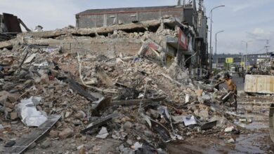
Trinidad’s Quake-Raised Coast Turns Fool’s Gold into Warning Signs Today
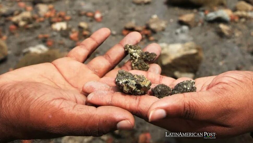
After Venezuela’s violent June earthquakes, Trinidad’s southwest shore rose like a warning, stranding sea life, cracking roads and exposing how close Caribbean neighbors live to disaster, geology, politics and memory along a coastline suddenly rewritten in seconds before visitors arrived.
A Shoreline Jumps, and Trinidad Looks Down
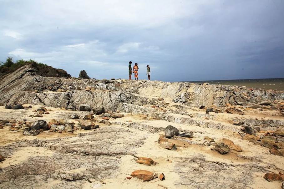
In Galfa, on the Cedros coast, the beach no longer begins where people remember it. The sea has stepped back, or rather, the land has lunged upward, leaving a raw new edge of Trinidad exposed to salt, sun, and disbelief. What had been seabed is now a strange, bright scar. Fish bones. Crab shells. Dead rays. Rock glittering with pyrite, the old fool’s gold that has sent visitors picking through the rubble as if the earth had staged a treasure hunt.
The treasure is really a warning.
Geoscientist Xavier Moonan, who surveyed the damaged zone after Venezuela’s June 24 earthquakes, told EFE that parts of Galfa rose about 20 feet in seconds. The figure is almost too clean to absorb. Six meters of vertical change, not over centuries, not through slow erosion or mythic island-making, but in the time it takes a person to turn toward a roar.
“The displacement happened in a matter of seconds. Hundreds of animals died on that beach in a matter of seconds,” Moonan told EFE while inspecting the coast.
The deaths make the science legible. A fault line can feel abstract until a stingray is left high above the tide. A tectonic plate can sound like textbook language until a road cracks, a property is damaged, and a fishing community finds its shoreline relocated by force.
Cedros sits only about seven miles from Venezuela, across water that hides a longer intimacy. Trinidad was separated from the South American mainland roughly 7,000 years ago, when rising sea levels turned it into an island. That history matters because the recent earthquakes did not strike some distant other place. They shook a shared geological body. The border is political. The fault systems are not impressed.
The Dead Animals Tell a Larger Story
The human eye is drawn first to the grotesque: marine animals stranded above the new coast, bones scattered where waves once moved. Then comes the political reading. Trinidad and Tobago has long lived with the contradictions of a small island state with continental proximity, energy wealth, coastal settlements, fragile infrastructure, and a disaster imagination often shaped more by hurricanes than by earthquakes.
This event argues for a broader fear.
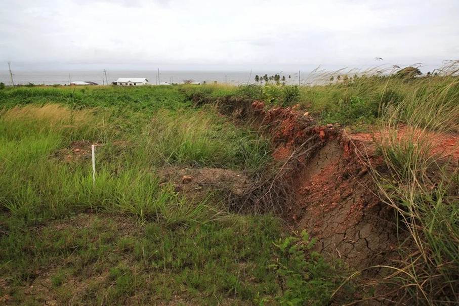
Moonan told EFE the uplift was not volcanic in origin. The prolonged shaking destabilized slopes, triggering movement that pushed parts of the coast and adjacent seabed upward. Experts also documented about six and a half feet of ground displacement in L’Envieuse, another coastal community. That number may sound smaller than Galfa’s dramatic rise, but for a house, a road, a drainage line or a hillside already soaked by rain, two meters can be the beginning of a new map.
The data points form a rough social diagnosis. A 20-foot uplift means the hazard is not theoretical. Hundreds of dead sea creatures mean ecosystems can be destroyed instantly by land movement, not only by oil spills, warming seas, or overfishing. Cracked roads mean rural isolation can deepen fast. Damaged property means private loss often arrives before public policy catches up. The gathering crowds hunting pyrite show another Caribbean truth: disaster also becomes spectacle, economy, and rumor.
There is a lived-in fatalism in places where the ground is known to be restless. People joke. They go look. They collect stones. They take pictures. But beneath that theater lies an old vulnerability shared across Latin America and the Caribbean: governments often respond well to visible emergencies while underinvesting in prevention, land-use discipline, and building codes before the earth moves.
Moonan warned EFE that rain could worsen the instability. Once enough water enters the soil, he said, the area will continue sliding. That detail should unsettle officials more than the dead fish. Trinidad’s southwest peninsula is not a sealed incident site. It is a wet, inhabited, tectonically active landscape where one hazard can feed another.
Venezuela’s Grief Crosses the Water
The earthquakes that lifted Trinidad’s coast devastated Venezuela. According to the latest Venezuelan government toll included in the notes, the magnitude 7.2 and 7.5 quakes killed at least 3,535 people and injured 16,740. Those numbers sit heavily beside the altered Trinidadian beach. On one side of the water, families bury the dead. On the other hand, geologists read a coastline that has been shoved into a new shape.
The humanitarian response in Trinidad speaks to another old regional bond. Local authorities and citizens have been preparing food, bottled water, hygiene products, medical supplies, and other aid for Venezuela. Local Government Minister Khadijah Ameen said more than 1,000 aid packages had already been prepared and urged donations through the Venezuela Disaster Relief Fund at First Citizens Bank.
Edward Moodie, vice president of the Trinidad and Tobago Red Cross, told EFE the organization would work directly with the Venezuelan Embassy in Port of Spain to coordinate humanitarian distribution to affected communities.
That cross-water solidarity is not sentimental. Trinidad has absorbed Venezuelan migration, depended on regional trade routes, argued over borders and energy, and shared family, language, and labor ties that predate the latest crisis. The earthquakes reveal a region linked by more than compassion. Risk travels through geology, migration, markets, and memory.
The mud volcanoes make the lesson harder to ignore. Moonan told EFE that all the mud volcanoes in the affected southwest are active, naming Los Iros, L’Envieuse, Balka Devi, Columbia Estate, Fullarton, San Quintin and the Galfa/Cedros system. He expects activity to ease in the coming weeks, but the episode shows how closely linked Trinidad’s faults and mud volcano networks are.
That should push policy beyond cleanup. Land-use approvals in geologically sensitive zones need sharper scrutiny. Building standards should treat ground movement as a practical risk, not an academic footnote. Rural roads, emergency routes, coastlines, and slopes need maps that officials actually use.
At Galfa, the new coast glitters with fool’s gold. It is tempting, almost human, to bend down and pocket a shiny fragment. Trinidad’s harder task is to look up, read the fracture, and believe what the island has just been told.
Also Read: México World Cup Masks Make Lucha Libre Soccer’s Wildest Sidequest